My Old Home River Now Runs Free

Photos courtesy of Squannatissit Chapter Trout Unlimited and Massachusetts Department of Environmental Resources.
Bob Mallard - National Vice Chair, Native Fish Coalition
Before moving to Maine nearly twenty years ago I spent just over twenty years straddling the border of Massachusetts and New Hampshire. My time was split between an apartment in Pepperell, Massachusetts, my last rental, and a house, my first, in neighboring Brookline, New Hampshire. The Nissitissit River begins in the latter town and ends in the former .
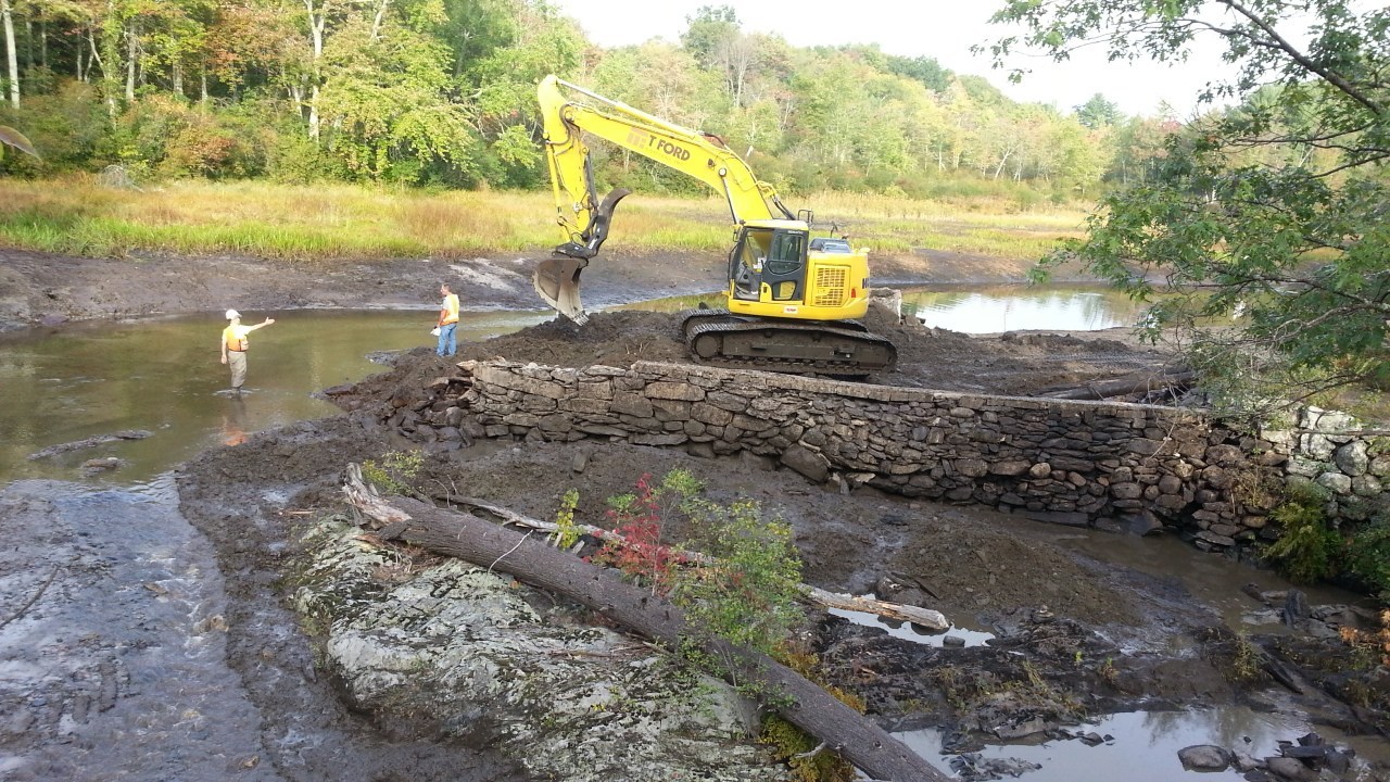
While in Pepperell, I lived within a 5-minute drive of where the Nissitissit River empties into the Nashua River. I could walk to Millie Turner Dam (see below), the only fish-blocking dam remaining on the river, and I kept a canoe in the woods on the small impoundment above the dam which I could access by crossing a small field and walking 100 yards through the woods right across from my apartment.
In Brookline, my backyard bordered Gould Mill Brook just a couple of hundred feet upstream of where it empties into Lake Potanipo, the source of the Nissitissit River. The stream was, and still is, stocked with brook trout, with the occasional wild fish found upstream in the woods. I could walk to the outlet of the lake and fish the headwaters of the river for recently stocked rainbows.
The land abutting the Nissitissit River was a mix of swamp and relatively mature forests. The river was low-gradient and meandering. It braided in a few places and the upper half was broken up by small beaver dams that remained in place year after year. There were deer, beaver, muskrat, the occasional otter, and turtles — including rare wood turtles.
The Nissitissit River was primarily a stocked nonnative rainbow trout fishery, with the occasional brown trout. Brook trout were stocked as well, mostly in New Hampshire, and I caught the occasional small wild-looking fish that were likely drop-downs from one of the numerous small tributaries, one of which, Sucker Brook, has seen some recent habitat work.

To say I know the Nissitissit River well would be an understatement. In fact, I don’t believe I have ever known a river or stream more intimately and completely than I did the “Niss.” I fished and canoed the river regularly and knew every inch of it. In fact, there is not a foot of river that I have not been on from its source to its termination.
I spent much of my time fishing the Nissitissit River Wildlife Management Area due to the fly-fishing-only and catch-and-release restrictions. Originally running from Sucker Brook to Gilman’s Pool, it now runs from the New Hampshire border to the Prescott Street bridge, a threefold increase from when I lived there. I fished near the Brookline, Prescott, Hollis, and Mill Street bridges as well.
Walk-in access to the Nissitissit River was limited to the aforementioned Wildlife Management Area and a few bridges. The land between the access points was mostly private making the river tough to access on foot. It was best fished from a canoe which allowed you to cover ground and access areas that were otherwise inaccessible.
I floated the Nissitissit River in a canoe from bridge to bridge, fishing as I went. I put in behind the Brookline Police Station, and the Brookline Street and Prescott Street bridges. While I usually did single-bridge floats, if the water was right and the fish were biting, I sometimes did double-bridge floats that took an entire day to execute. The upper section was my favorite to float as I rarely saw anyone else.
The Nissitissit River was, and still is, a beautiful place. Other than the stocked fishery, it was a natural and very lightly developed river that flowed unimpeded until it reached Millie Turner Dam within a mile or so of its termination at the Nashua River. There was an old defunct dam a half mile downstream of Gilman’s Pool, and another just downstream of the Prescott Street Bridge.
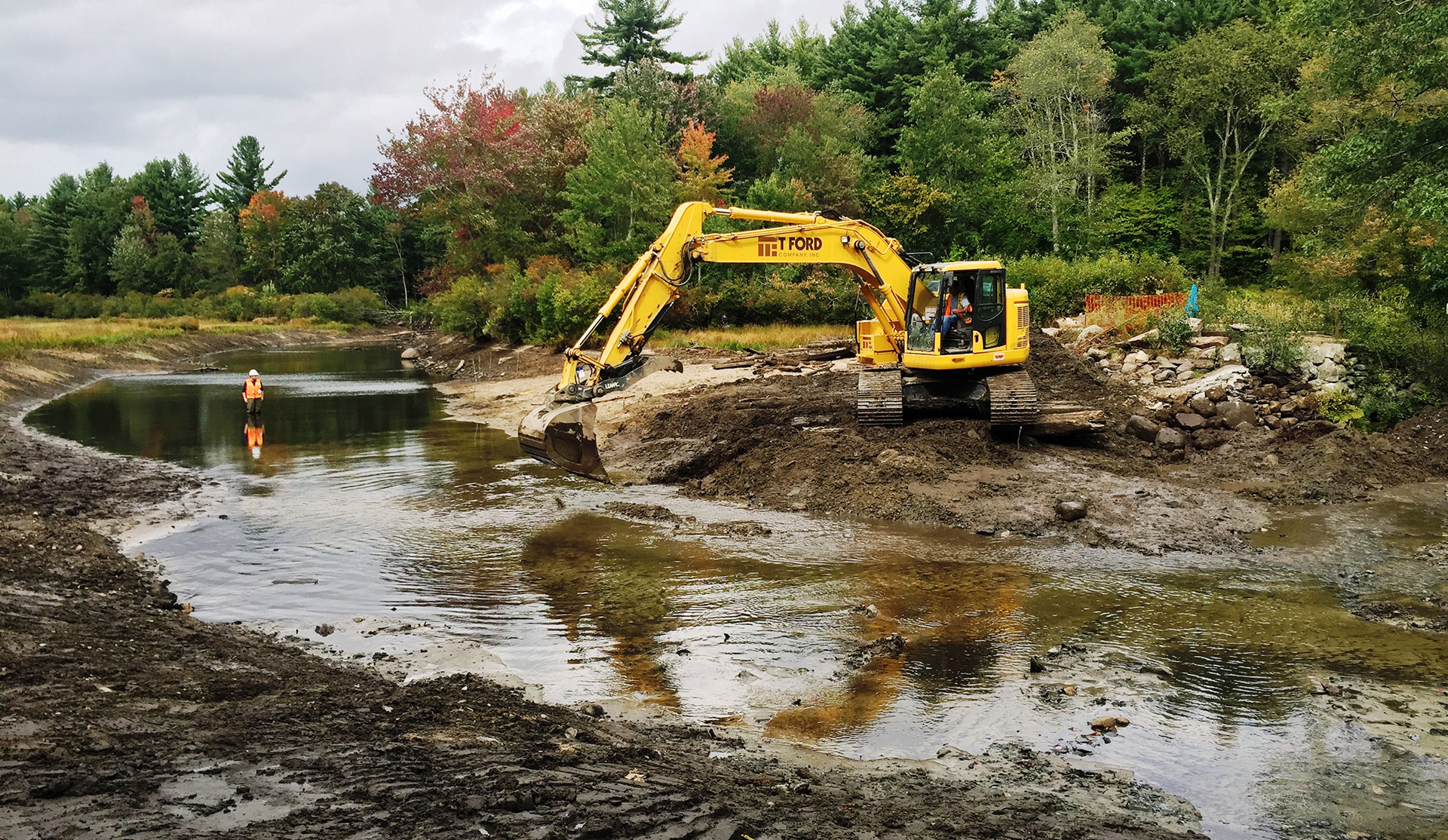
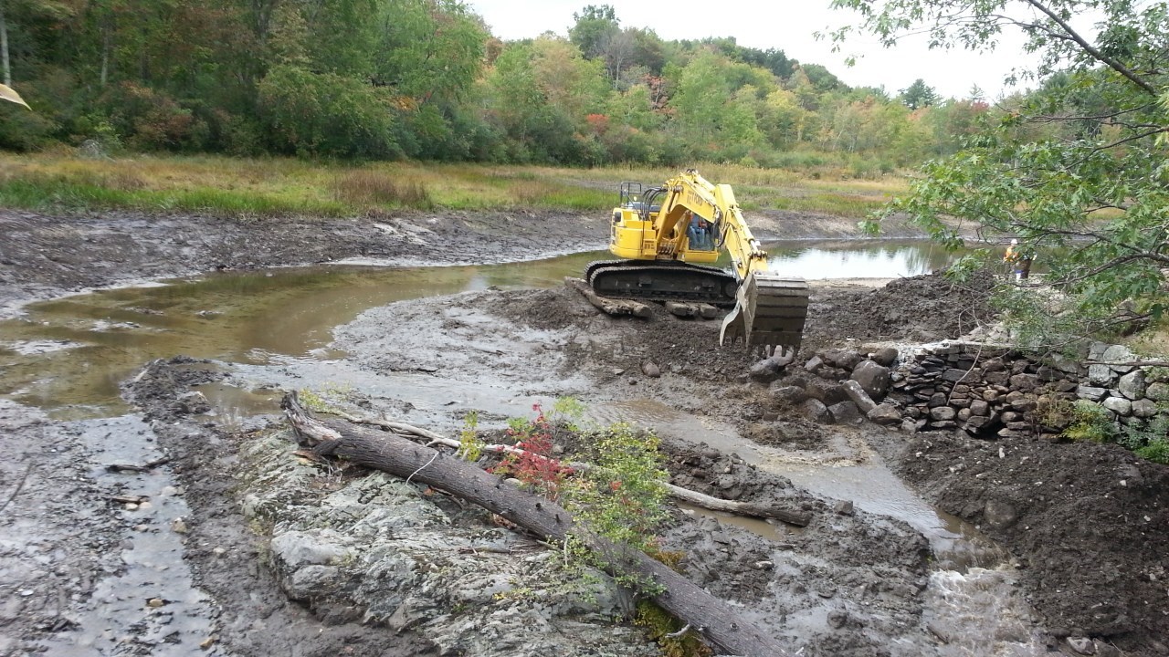
In September 2015, the Millie Turner Dam was demolished, opening up the entire Nissitissit River to fish-passage and removing a long shallow impoundment that warmed the lower river and piled up silt behind it. This freed the river making it one of the all too rare rivers or streams in the area without a fish-blocking dam or crossing.
While I have not seen the Nissitissit River since the dam was removed, I plan on visiting my old stomping grounds as soon as I get a chance to. I’d like to try to canoe it from top to bottom, something I couldn’t do when I lived there without portaging around the dam.
Special thanks to all who helped free this beautiful suburban treasure, you have accomplished something truly measurable.

The area above Millie Turner Dam before and after the dam was removed.