Trout Brook - Dover, Massachusetts: 2023 Year-End Report (Channings Pond to Headwaters)

Introduction
Trout Brook in Dover was identified as the “coolest” stream in the Charles River watershed, the largest watershed wholly in Massachusetts, in a 1997/1998 water quality assessment report published by Massachusetts Dept. of Environmental Protection, Division of Watershed Management. The report refers to Trout Brook as having “High Quality Water,” and states that “…it does support a [wild] native eastern brook trout population.”
A visual assessment of Trout Brook at the 2 primary road crossings, Springdale Avenue and Haven Street, conducted by Native Fish Coalition in early 2023 showed a stream that looked nothing like it did just a generation or two ago. The once clear water was noticeably tannic, and the historically clear sandy bottom was covered in decaying organic matter. The last time wild native brook trout were formally confirmed in the stream was 2007.
NFC chose Trout Brook in Dover, Massachusetts, as the beta site to test our Holistic Stream Assessment/Restoration program. Our reason for doing was twofold: The stream was facing many threats and challenges, and there was no plan in place to try to address the faltering coldwater fishery/ecosystem. This unique aquatic ecosystem conservation methodology takes a “big picture” view starting at the headwater and working down to gain a full understanding of what is going on.
Status
While NFC and our partners have not completed the physical assessment, fish population survey, water quality sampling, and temperature monitoring phases of our Trout Brook initiative, there are some general observations we would like to share in regard to the section of stream from the dam at Channings Pond upstream to the headwaters.
Note that the Channings Pond referenced in this document is upstream, or south, of Springdale Avenue on private property owned by the McKoy-Lesser family. This is not the small manmade pond just north of Springdale Avenue on town-owned land known as Channing Park.
Notes
Due to an unusually wet/cool season, we saw Trout Brook at its modern best, not its worst. We were unable to ascertain whether the stream above Channings Pond is subject to intermittent flows, which is one of our concerns. In addition, we were unable to determine if water temperatures in the headwaters get too high to support wild brook trout.
We also had problems with several temperature loggers. The logger at one location was removed from the water and left on the bank on 6/26. It wasn’t discovered and reinstalled until 8/13. Another logger was never found and was likely removed. In another case, a logger was either lost to high water or floating debris, vandalized, or lost when we pulled the mounting post in the fall.
Problems with the 3 temperature loggers limited what we were able to learn about water temperature on upper Trout Brook. We were however able to form a partial picture and general understanding of what is going on via the loggers that were not impacted, as well as manual testing done during various site visits.
Findings
Channings Pond and Dam
Channings Pond is a century-plus-old manmade impoundment created by damming Trout Brook just downstream of a small spring stream tributary entering from the west.

Channings Pond looking upstream. Trout Brook enters the pond at top left…
Based on manual depth checks, Channings Pond appears to have a maximum depth of just 7-8-feet at this time. This is roughly half the height of the dam and the natural streambed just downstream of the dam. Most of the pond is just 3-4-feet deep.
Decaying organic matter in Channings Pond is 3-4-feet deep, indicating that the pond is much shallower than it once was. The bottom at the face of the dam slopes upward and almost to water level. The water is off-color, the result of decaying organic matter. There is also extensive weed growth which could be affecting dissolved oxygen levels.
The large top-flow earth and stone dam at Channings Pond isolates the headwaters of Trout Brook from the rest of the stream from an upstream fish-passage standpoint. There is a small dug overflow channel on the east side of the dam that appears to be dry most of the time.

The dam at the outlet of Channings Pond. While the lower perched drop may be navigable for fish, at 6-8-feet the upper perched drop is not…
While we were unable to locate/retrieve the temperature loggers deployed immediately above and below the pond, we were able to get two sets of manual temperatures. In late June, the water coming out of the pond was slightly cooler than the water coming in. This indicates that there is some level of subsurface springs feeding the pond. In late August, however, the water coming through the dam was 2 degrees warmer than that coming into the pond.
It is likely that the pond is a source of warming due to the exposed surface area and shallow depth. It is also likely that the pond is a source of some level of evaporation. The situation would likely be worse in a dry and/or warm year as we have been experiencing over the last decade or so. In fact, it is possible that the pond could cease outflowing in extreme situations.
Channings Pond acts as a decaying organic matter trap due to its inability to push debris downstream or decompose it faster than it accumulates. Sans any human intervention, the pond will continue to get shallower, warmer, and more weed choked.
Cement Dam and Pool
There is a 3-sided cement dam upstream of Channings Pond that impounds an area roughly 30-feet by 80-feet. The dam is in disrepair and is likely over 50-years-old. Water is released via a small mid-depth opening in the face of the dam. While not in use, the dam is equipped with flashboard slots for raising the water level. Even without the flashboards in place there is a 16-inch vertical drop to the natural streambed which prohibits the upstream passage of fish.
While our initial assessment was that the dam and pool were built to facilitate private aquaculture, possibly rearing fish for Channings Pond, we have not been able to prove or disprove this theory. The reason for our hypothesis is that the cement dam and upstream berm resemble similar structures elsewhere used to rear fish in-stream.

Cement dam and pool looking upstream. Water exits the dam at the lower left…
In addition to widening the stream to facilitate construction of the dam and creating the small pool above, it appears that the stream was dredged to add depth to the pool as well. Based on probing around the face of the dam, the bottom of the pool appears to be 3 feet or so lower than the natural streambed immediately downstream of the dam.
Multiple manual water temperature tests indicate that the dam and pool were built on a natural spring. Specifically, the water coming into the pool was warmer than that exiting the pool at the dam by up to 5 degrees Fahrenheit at certain times.

The cement dam looking downstream. Note the highwater mark on the cement from when the flashboards were in place and functioning…
The pool above the cement dam is filling with decaying organic matter due to the mid depth release of the dam. Based on the odor and bubbling, it is likely negatively impacting dissolved oxygen which could affect aquatic life in the stream below as well as Channings Pond. When we cleared debris from the opening in the dam, the water dropped a foot or so and the smell and bubbling increased significantly.
Earthen Berm
There is an earthen berm just upstream of the cement dam that serves as the 4th wall for the pool above the cement dam. The purpose of the berm is unclear, but if the dam was built to create a private swimming pool as we have been told, it may have been constructed to keep debris from entering the pool from upstream.

The earthen berm. Note the water backed up upstream, or left, of the berm…
Water flows through the earthen berm via two 16-inch clay pipes. Both pipes are in disrepair and the flow in the easternmost pipe is notably restricted. While the westernmost pipe appears to be functioning as intended, it is insufficient to handle most flows and water is being backed up upstream for roughly 100 yards or so.
The restricted flow has widened the stream above the berm notably. This has resulted in tree loss and increased light penetration. The loss of canopy and widening of the stream is increasing water temperature substantially at certain times of year. Temperature tests performed in late June showed a difference of 15.5 degrees Fahrenheit just ¼ mile upstream of the berm.

Downstream end of the pipes at the earthen berm. Flow through the right, or eastern, pipe is notably restricted...
While not an issue at this time due to the two blockages downstream, it is likely that the berm blocks or at least restricts fish passage.
Vernal Pond
Although possibly outside of the McKoy-Lesser property, there is a small vernal pond 500-feet or so south of the earthen berm just to the east of Trout Brook. While not currently part of the Trout Brook watershed, and it likely never was naturally, there is a small manmade canal connecting the pond to the stream.
While the accumulation of leaves in the canal bed indicates that no water has moved between the pond and stream for years, it must have been dug to facilitate such. The presence of the canal and lack of flow between the pond and stream in what was an unusually rainy year implies that the source of the pond, groundwater and/or snowmelt, is not what it once was.
Stream Geology
As a result of a site inspection, the section of Trout Brook upstream of Channings Pond was referred to as “vertically and horizontally stable” by Dr. Douglas Thompson, Professor of Geoscience at Connecticut College and a fluvial geomorphologist. This means that the impact of rain and snow melt is relatively minimal and the stream receives most of its water from ground sources.

Dr. Douglas Thompson inspecting the headwaters of Trout Brook…
Water Temperature
Water temperatures in Trout Brook upstream of the impounded water above the earthen berm remained conducive to wild brook trout throughout the season.

Note that water temperature upstream of the earthen berm was rarely stressful to wild brook trout…
Temperatures from the impounded water upstream of the earthen berm downstream to Channings Pond fluctuated between safe and stressful for wild brook trout from mid-June through mid-September. At certain times, the increase in temperature from the headwaters to the earthen berm was significant.

Note the 15+ degree increase in water temperature on roughly 6/26 between the culvert at the abandoned railroad bed and the earthen berm, a distance of just 1/4 mile…
Beavers
Beaver activity in upper Trout Brook is minimal, and limited primarily to Channings Pond. Based on the size of the beaver dam at the upstream end of the pond, beavers have been present for multiple generations. Beavers have taken down a number of trees in the vicinity of Channings Pond resulting in some level of canopy loss near the inlet of Trout Brook.

Large beaver dam at upstream end of Channings Pond. Note impounded water above dam…
The beaver dam at the upstream end of Channings Pond is impounding water 100 or so feet upstream. It is also possible that the beaver dam is negatively impacting fish-passage, or acting as a barrier to such. The lack of fish upstream of the pond and presence of fish in the pond would imply this is the case.

Many trees, including large mature ones, have been lost to beavers around Channings Pond and where Trout Brook enters the pond…
Beavers have also dammed the outflow of the stone dam resulting in low-point, east end, overflow which left unchecked could compromise the integrity of the dam. A beaver-deceiver was installed in the dam opening recently to address the problem.
Fish
The dam at the outlet of Channings Pond prevents the upstream passage of fish. Fish are however able to move downstream via the dam outflow and based on the results of e-fishing exercises do so. It is possible that the installation of the beaver deceiver has increased the downstream movement of fish due to the sub-surface release.
While there are insects and amphibians throughout Trout Brook upstream of Channings Pond, it appears to be devoid of fish based on extensive visual inspection and electro-fishing performed by MassWildlife with support from NFC. Crayfish were found between Channings Pond and the cement dam. Insect life in the extreme headwaters is unusually robust, possibly due to the lack of predation.

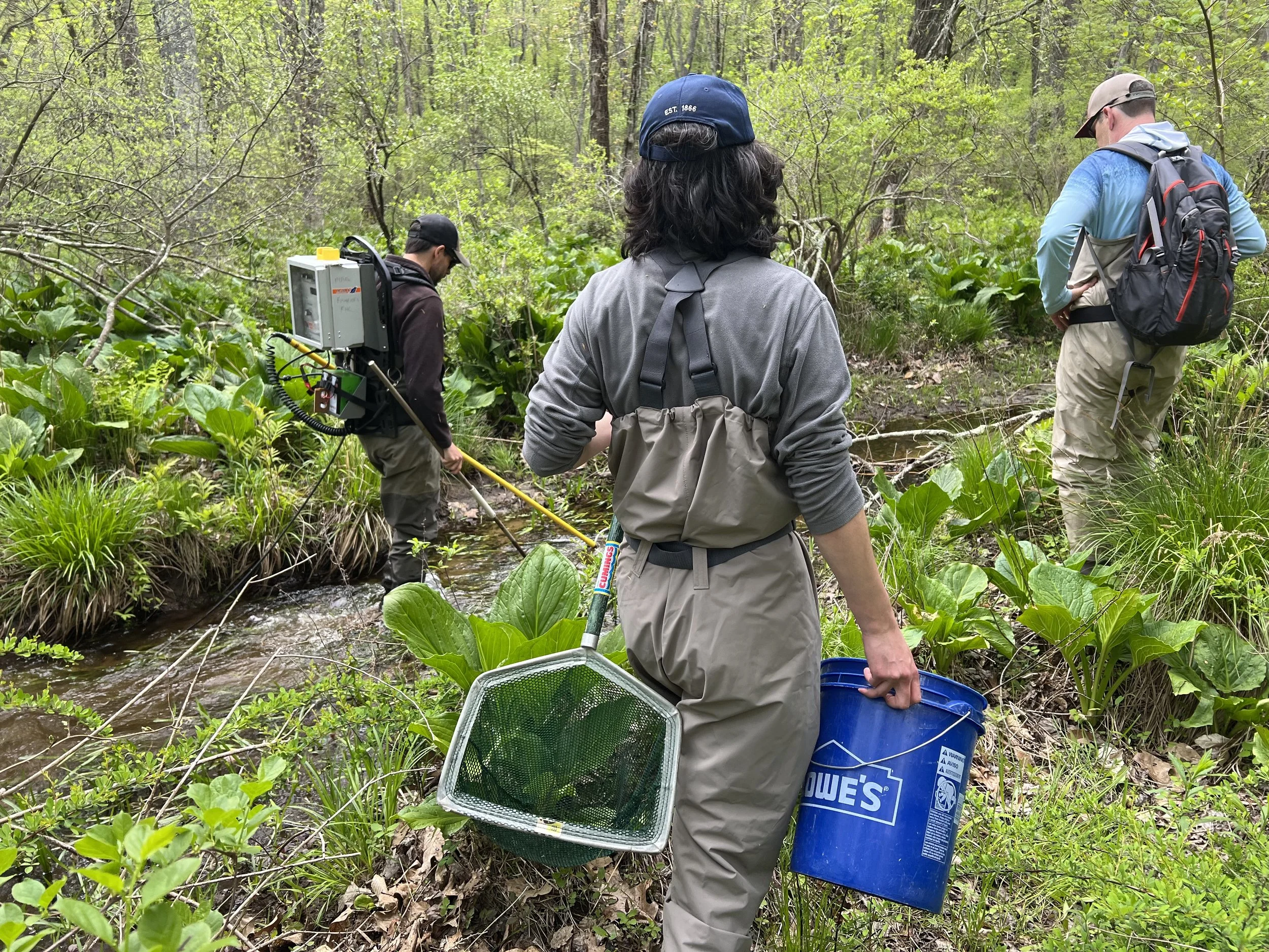
Adam Kautza, MassWildlife, and NFC volunteers e-fishing the headwaters of Trout Brook…
Channings Pond is home to self-sustaining populations of nonnative largemouth bass and bluegill, a prolific form of sunfish, both of which are highly invasive to native brook trout. Additional angling and trapping would determine if any other species of fish are present.
Both bass and bluegill are also present in Trout Brook immediately downstream of Channings Pond. This indicates that the downstream passage of fish from Channings Pond is happening, as there appears to be at least some level of fish-passage blockage between the pond and Springdale Avenue at a dirt road crossing that would limit upstream movement.

A juvenile nonnative largemouth bass from downstream of Channings Pond…
The presence of fish in Channings Pond but not the stream above is unusual. It is an indication that there is an issue with regard to fish-passage, as well as the possibility that some catastrophic event(s) such as dewatering due to extended drought conditions caused a die-off upstream of the pond.
Conclusion and Opportunities for Mitigation
The five things that are negatively impacting the headwaters of Trout Brook the most are, in order, the dam at the outlet of Channings Pond, Channings Pond, the earthen berm, the cement dam, and the beaver dam at the head of Channings Pond.
Channings Pond and the dam that created it are well over a century old and wholly on property owned by the McKoy-Lesser family. Both the pond and dam have aesthetic, economic, recreational, and historical value and must be viewed accordingly.
The earthen berm, cement dam, and beaver dam however have little if any aesthetic, economic, recreational, or historical value, and addressing them would be attainable and helpful to the upper watershed, including Channings Pond, if there were interest in doing so.
Earthen Berm
Removing the earthen berm would allow the stream above to return to its natural channel. This would reduce stream widening, lessen the amount of stagnant surface water, decrease warming, and lessen evaporation. It would also allow for subsequent natural and assisted revegetation in the currently flooded area which would further improve the stream and pond habitat.
NFC believes that the berm could be dismantled using hand tools and volunteer labor. Our assumption is that the clay pipes, one of which is broken and restricting flow, were dropped in the natural streambed prior to constructing the berm. Breaching the berm between the outside edges of the two pipes would restore the historic stream channel.
Cement Dam
Breaching the cement dam would allow Trout Brook to flow unobstructed by manmade structures from the downstream end of the culvert at the abandoned railroad bed to Channings Ponds, while providing fish passage which is currently blocked. This would also eliminate a source of impounding and trapped decaying organic matter, and likely improve dissolved oxygen.
NFC believes that breaching the existing opening in the dam down to the natural streambed would have a positive impact on the stream, as well as Channings Pond, without the need for heavy equipment or a complete removal of the structure. Due to its age, we below this could be done using hand tools (ice chisel and sledgehammer) or possibly a jackhammer.
Once the water level has dropped and the stream is flowing freely, you could give it a year to see what happens through natural stream-cutting, organic matter transfer, settling, and drying, as well as revegetation.
Beaver Dam
While the problems associated with beaver activity will persist as long as they are present, NFC believes that there are some things that could be done to improve fish-passage on the upper stream, reduce impounding at the head of Channings Pond, lessen additional tree loss, and restore some level of canopy just upstream of the beaver dam.
Like the earthen berm, NFC feels that much of this could be done with volunteer manpower. Deconstructing the beaver dam would reduce impounding upstream, and installing some sort of beaver-deceiver culvert(s) could help keep the water moving. This is not however a permanent solution and some level of ongoing maintenance would be required.
Once the water drops above the beaver dam, some level of replanting using fascines live stakes would help increase canopy. The remaining large trees around Channings Pond and Trout Brook immediately upstream could be wrapped using “cylinder cages” made of galvanized fence wire with 2-3” openings to prevent further loss.
Summary
As with most large scale aquatic habitat projects, you need to start at the top and work your way down in order to fully understand the situation, while recognizing the highest level of benefit possible from your work and avoiding work that does not yield the desired result.
To be clear, NFC is not sure that upper Trout Brook can support wild native fish under the current conditions, and irrespective of what is done to address the problems noted above. Additional temperature and flow data collected during a more typical season would be required to determine if the habitat upstream of Channings Pond is suitable to support native brook trout year-round. Unfortunately, the presence of nonnative and highly invasive largemouth bass and bluegill in Channings Pond eliminates it as a source of winter, warm water, and low water refuge.
The immediate goal would be to try to get as much, and as cold and well-oxygenated water moving through the headwaters of Trout Brook as possible to improve water quality downstream of Channings Pond. By default, Channings Pond would benefit as well.
Improving the situation in regard to the headwaters of Trout Brook would require the support of the local community, town and state government, landowners, and others. Without intervention, the situation will get worse not better.
It is important to note that we do not know, and likely never will, when the headwaters of Trout Brook lost its brook trout. It is quite likely that this occurred generations ago and possibly within a couple/few decades of the construction of the dam at Channings Pond.

Last formal confirmation of wild native brook trout in Trout Brook, August 2007
Brook trout did however persist in Trout Brook as far downstream as Haven Street until at least 2007. According to one source we believe to be reliable, they were extant upstream of Springdale Avenue until at least 2009. This needs to be our focus regardless of what does or does not happen in regard to the headwaters.

Last documented wild native brook trout in Trout Brook, 2009
Special thanks to the McCoy-Lesser family for giving us access to their property, dover resident and nfc supporter David Peress for coordinating local introductions, adam kautza from masswildlife for his help with e-fishing, lisa kumpf of charles river watershed association, nfc advisory council member dr. douglas thompson, nfc national chair emily bastian, nfc national vice chair - northeast brian cowden, and massachusetts nfc members jeff moore, brian hutchison, max heidelburger, adam eaton, ian hughes, matt whipple, and will friedland.

The headwaters of trout Brook, what we would like to restore and preserve…
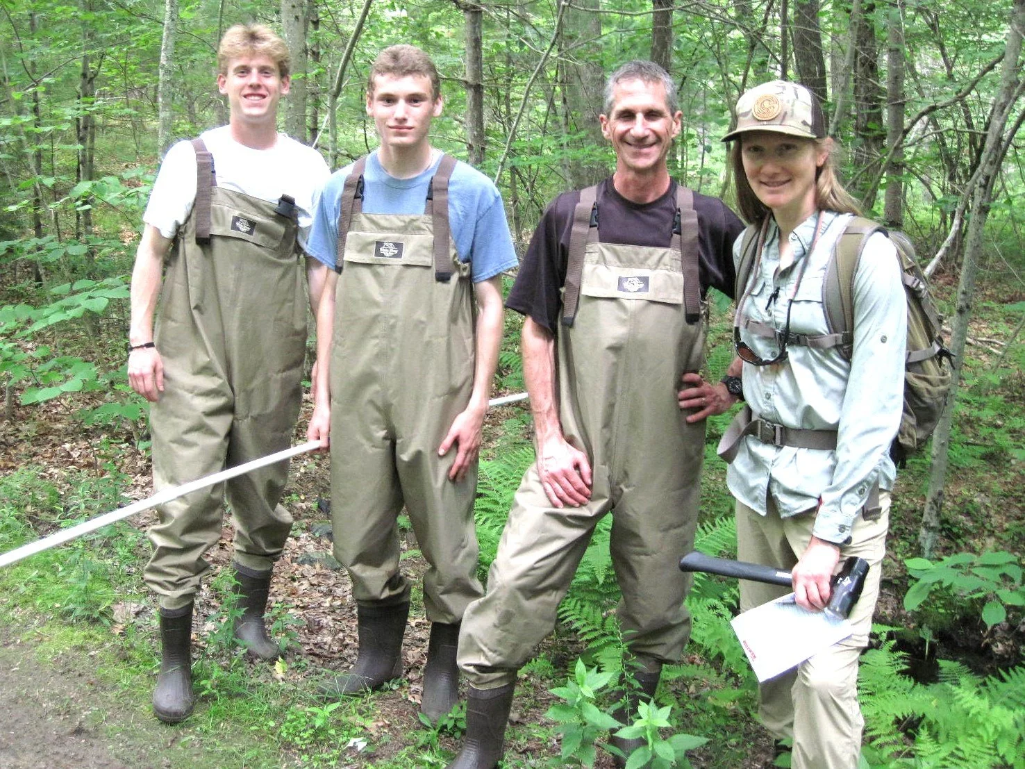
the nfc trout brook team